|
|
 |
|
Below:
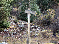
After about a 2 mile hike back the four wheel drive road, you
will come to the National Forest Posting Board. The trail and
sign for Mt. Huron (below) will be on your left. |
|
|

|
|
Begin by hiking back the four wheel
drive road for about 2 miles. This four wheel drive road, although
becoming increasingly rough, involves very little elevation gain
from your starting point of about 10,200'. After the first
half mile or so, you will see a dirt road that comes out on your
left, ignore this and stay on the low side near the south fork of
Clear Creek on your right. You will eventually come into somewhat of
a clearing and will pass some mining ruins on your left. Continue
straight onward and you will run into a National Forest
bulletin/sign at the end of the road. The trail and sign for the Mt.
Huron trail will be on your left.
At this point, the fun begins! |
|
|
|
|
|
 |
The trail will take you up a series of
fairly steep switchbacks through the forest.
After about forty five minutes or
an hour you will emerge on to a grassy plateau thinking that much of
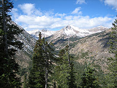
the elevation gain is behind you - you are wrong! As you follow the
trail across the plateau you will see 13er Browns Peak on your left
and massive Mt. Huron on the right.
You are about half way there. As
you follow the trail across the plateau you will arrive at the rock
strewn base of Mt. Huron where you begin the serious phase of your
ascent. Hopefully, you will avoid this trail when it is covered with
snow, ice and mud which served to greatly slow our trek to the
summit on October 4th. |
 |
|
Above:
Climbing up the switchbacks, you begin to catch some views... |
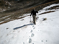
Above: Emerging from treeline we begin to catch our first
glimpse of Mt. Huron. We are still a little way from the plateau
(below left). |
 |
 |
|
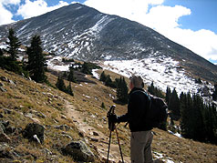
Above: Out on the grassy plateau, an SCE hiker consults a
map/guidebook. |
Above: Beginning the real ascent... up out of the plateau
and up Mt. Huron. |
|
|
|
|
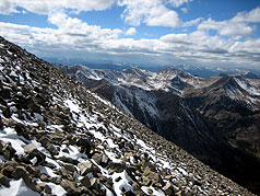 |
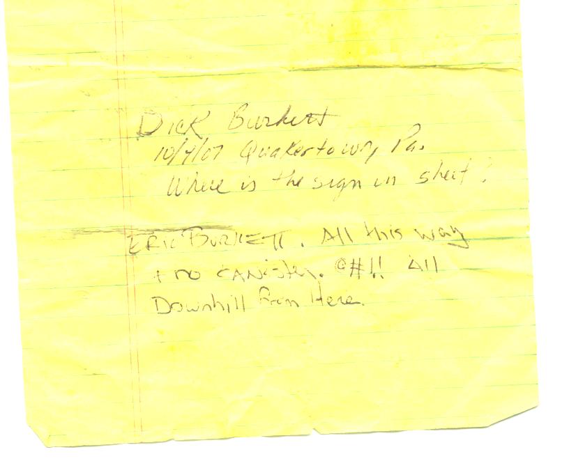
Arriving at the top, the views
are awesome. Have fun trying to locate Taylor Park reservoir,
Missouri Mountain etc. This is a real wilderness experience!
On this particular day, the summit registry/canister was buried deep under hard-packed snow. Wanting to leave a
record of our accent, we penned our entry on a scrap piece of paper
and tucked it away in a ziplock bag between a few rocks for
rediscovery in the future. It was since found by Roger J. Wendell, a
member of the Colorado Mountain Club who scanned the note in and
posted it on his website here: Click
Our Note: Discovered! To visit Roger's 14er website
click here
Before you begin be sure to
purchase Gerry Roach's "Colorado's Fourteener's (available from
the link for Weber's bookstore on this site) |
 |
|
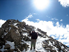
Above:
Steep Grades! You can guess which way is up. Strong winds were
encountered here. |
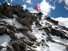
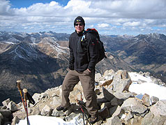
Above: Cresting the summit, an SCE climber on nears the top
(below red arrow). |
 |
 |
|
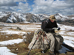
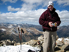
Above:
Directly beneath the summit, the sun is strong but the
temperature is numbing. |
Above:
Mt. Huron Summit! The registry/canister must have been hidden in
the snow... |
|
|
|
|
| |
and a good topo
map of San Isabel National Forest.
If you reach the summit,
then an
"I LIKE TO BE ON TOP"
T-shirt is well deserved!! Click the logo at right to get
one of your own!! >>> |

"I LIKE TO BE ON TOP"
T-Shirts.
Click Logo Above. |
|
|
|
|
|
|
|
|
|
|
|
|
|
|

|
beginner
|
|
intermediate
|
|
advanced
|
|
|
|
Black
Powder Pass
|
|
Mohawk
Lake
|
|
Quandary
Peak
14,265' |
|
|
|
Lily
Pad
|
|
Chihuahua
Gulch
|
|
Lincoln & Bross
14,291' / 14,177' |
|
|
|
St.
John's
|
|
Mt.
Royal
|
|
Bierstadt Peak
14,060' |
|
|
|
Mayflower Gulch |
|
Wheeler Lakes |
|
Willow & Salmon Lakes |
|
|
|
Loveland Pass |
|
Radical Hill Trail |
|
Upper Crystal Lake |
|
|
|
Salt Lick
Trail |
|
McCullough Gulch |
|
Gray's & Torrey's
14,278' / 14,267' |
|
|
|
Mesa
Cortina Trail |
|
Mt.
Sniktau |
|
Mt. Democrat
14,152' |
|
|
|
St. Mary's Glacier |
|
North
Ten Mile Trail |
|
Mt.
Victoria |
|
|
|
Sally Barber Mine |
|
Willow
Falls |
|
Mt.
Elbert
14,433' |
|
|
|
Oro
Grande Trail |
|
Eaglesmere Lakes |
|
Buffalo Mountain
12,777' |
|
|
|
Meadow Creek-Salt Lick |
|
Mosquito Pass |
|
Eccles Pass |
|
|
|
Shrine Mountain
Trail |
|
Webster Pass |
|
Mt. Huron 14,003' |
|
|
|
Ptarmigan Trail |
|
Ptarmigan via Wilder Gulch |
|
|
|
|
|
Peaks Tr. Barton Gulch |
|
Wheeler
Lake - Park County |
|
|
|
|
|
Hoosier Pass Loop |
|
Lenawee
Trail |
|
|
|
|
|
Spruce Creek Loop |
NEW! |
Nightmare on Baldy Mine |
|
|
|
|
NEW! |
Tenderfoot
Mountain Trail |
|
|
|
|
|
|
|
Did You find our FREE trail descriptions useful?
Please donate a buck or
two.
We appreciate your support! |
 |
|
|
|
|
|
|
|
|
|
|
|
|
|


